

Profile
Blog
Photos
Videos
Van Trip 2007

- Blog
- Oceania
-
Location Date New South Wales 1346454000 Queensland 1346367600 Victoria 1180825200 Northern Territory 
1180479600 South Australia 1179097200 -
Location Date Tennant Creek 1180479600 Barrow Creek 1180393200 Alice Springs 1179702000 Kings Canyon
1179529200 Yulara 1179183600

Yulara to Kings Canyon
Day 29 & 30
Kilometres travelled today... 341
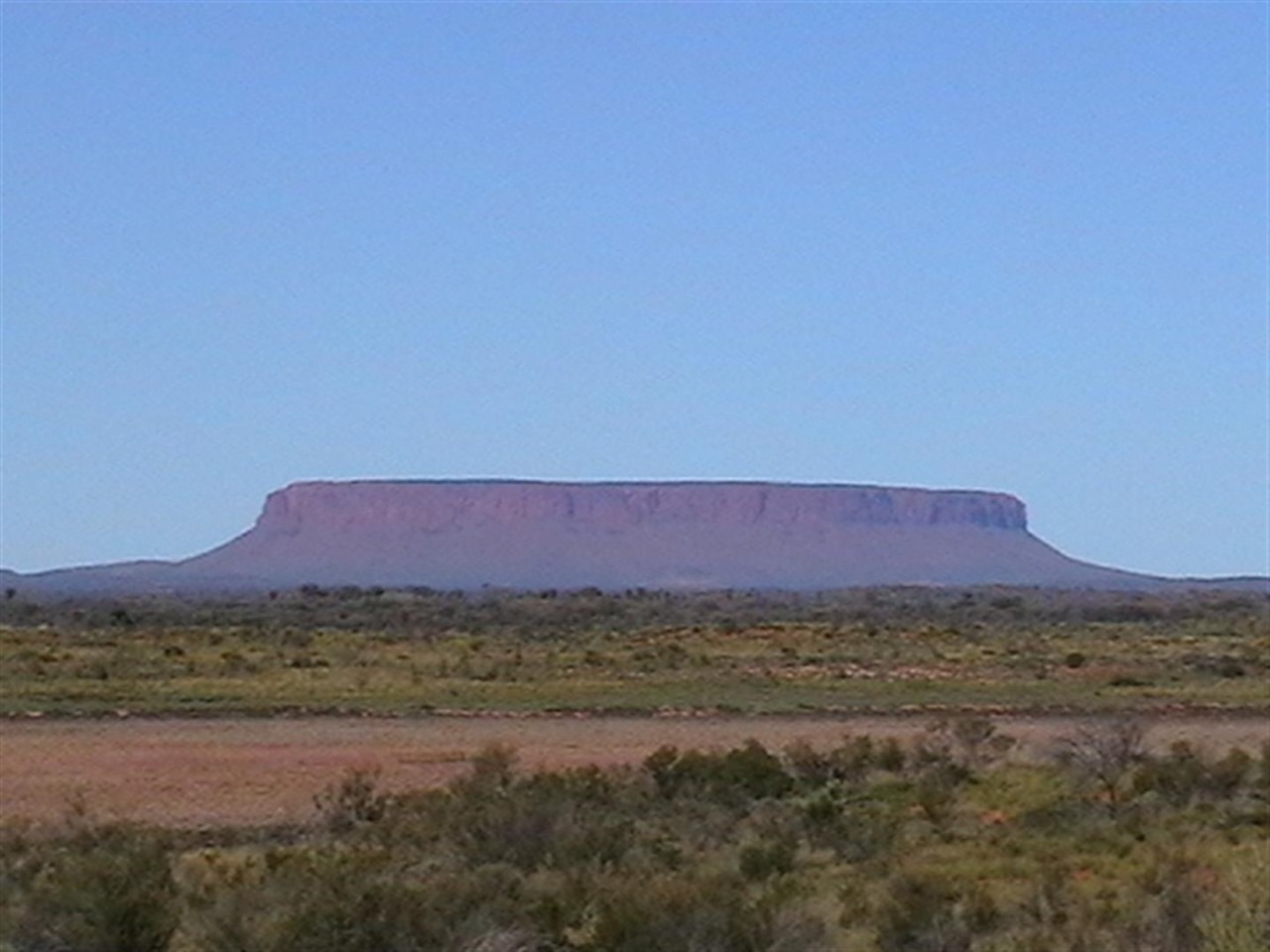
We left Yulara this morning for our 340 kilometre drive to King's Canyon, stopping after about 80 Kilometres to take photos of Mount Connor, which is located 75 kilometres southeast of Lake Amadeus at the border of the huge Curtin Springs Cattle Station. It reaches 859 metres above sea level, and 300 metres above ground level. It is a flat topped and horseshoe-shaped part of the rocky shelf thought to be beneath Ayres Rock. It can easily be confused with Ayres Rock, since it can be seen from the road to Ayres Rock.
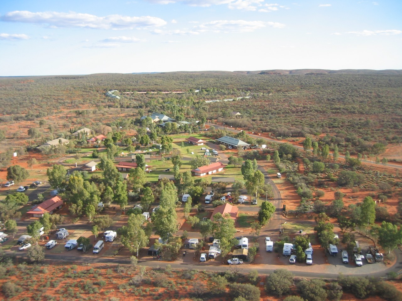
We arrived at King's Canyon about 1:40pm and checked into the Resort, site 48. The cost was $35.50 per night.
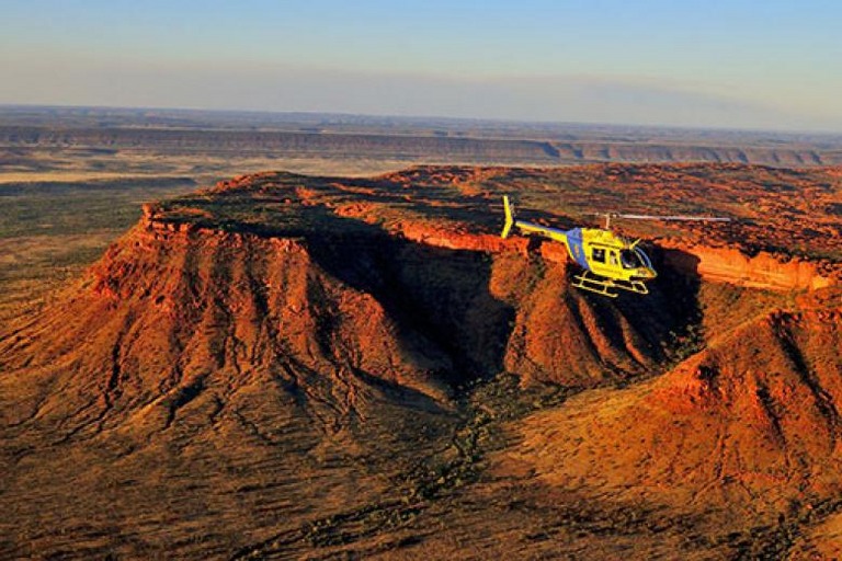
We had a wonderful 2 days at the Canyon, doing several of the walks and a helicopter flight.
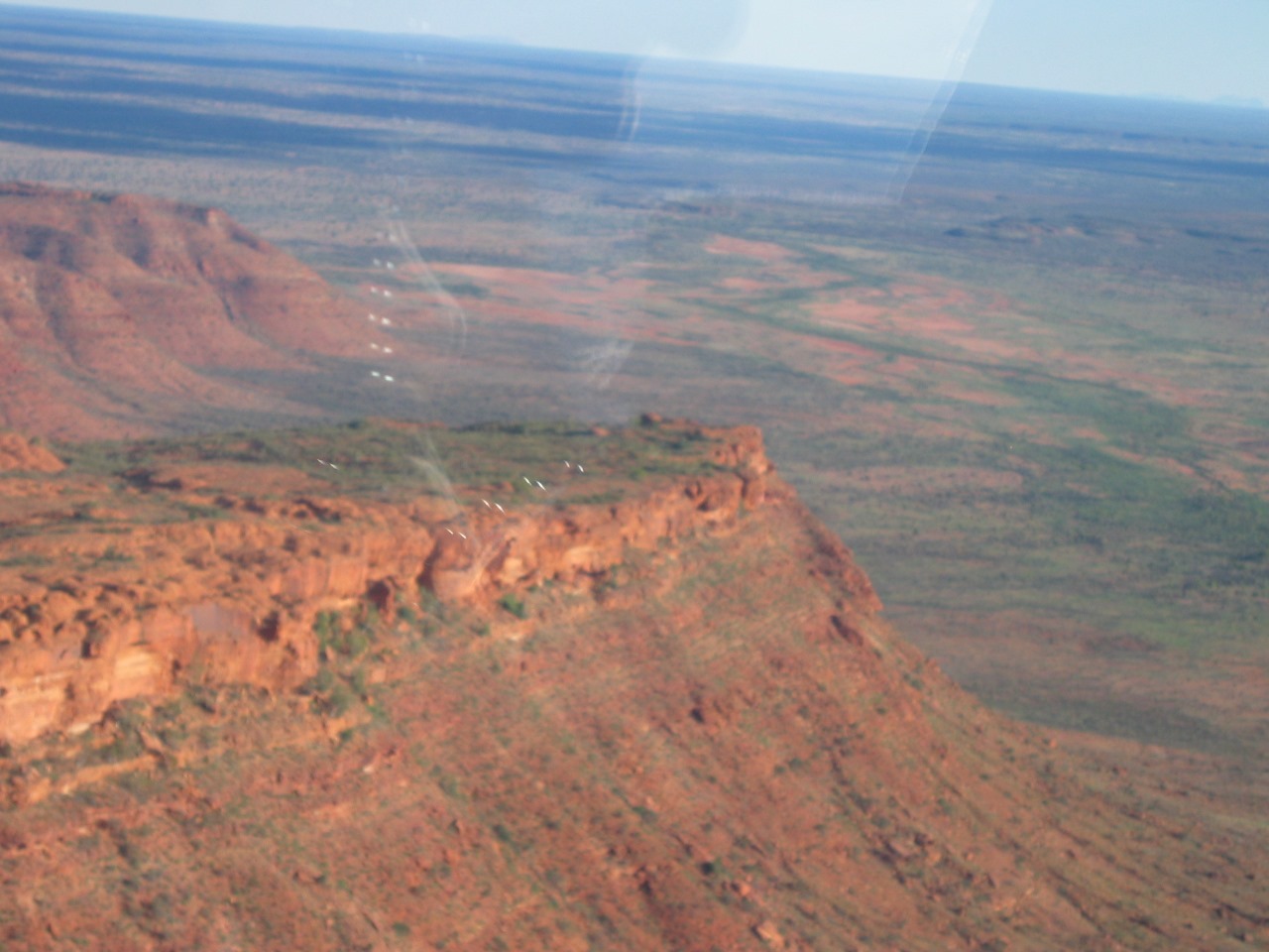
The walls of Kings Canyon are over 100 metres high, with Kings Creek at the bottom. Three walks exists at Kings Canyon. The 2 km (return) and approximately 1 hour Kings Creek Walk traces the bottom of the gorge. At the end of the walk is a platform, with views of the canyon walls above. The 6 km (loop) and 3-4 hour Kings Canyon Rim Walk traces the top of the canyon. A steep climb at the beginning of the walk, which locals call "Heartbreak Hill" (or "Heart Attack Hill", due to its steepness), takes visitors up to the top, with spectacular views of the gorge below and of the surrounding landscape. About half way during the walk, a detour descends to Garden of Eden, a permanent waterhole surrounded by lush plant life. The last half of the walk passes through a large maze of weathered sandstone domes. A slow descent brings the walkers back to the starting point.
I walked up Heart Attack Hill.
As with many tracks in the central Australian desert, visitors are advised to avoid walking during the middle of the day when the temperature is the highest and the sun most direct. Sunscreen, a hat, water and a fly net (in the hotter months) are essential.
The Kings Canyon Resort is 6 kilometres to the west and offers camping, budget rooms, standard hotel rooms and deluxe spa rooms, as well as restaurants and swimming pools. Kings Creek Station, 38 kilometres to the east is run and owned by Ian and Lyn Conway and offers alternative accommodation, and also provides camel rides and quad bike tours.
The highlight of our visit was the helicopter flight over the Canyon including a view of the rock platform where the Qantas ad. "We still call Australia Home" was filmed. The cast and crew had to be flown to the top by Chopper.
Another feature of our stay was laying in bed at night listening to the Dingos howling. They came right up to the perimeter of the Caravan Park. We always had to make sure we left nothing outside the Van before we went to bed.
It is Sunday morning 20th May and we are preparing for our drive to Alice Springs, which is a journey of approx. 490 Kilometres.
Day 29 & 30
Kilometres travelled today... 341
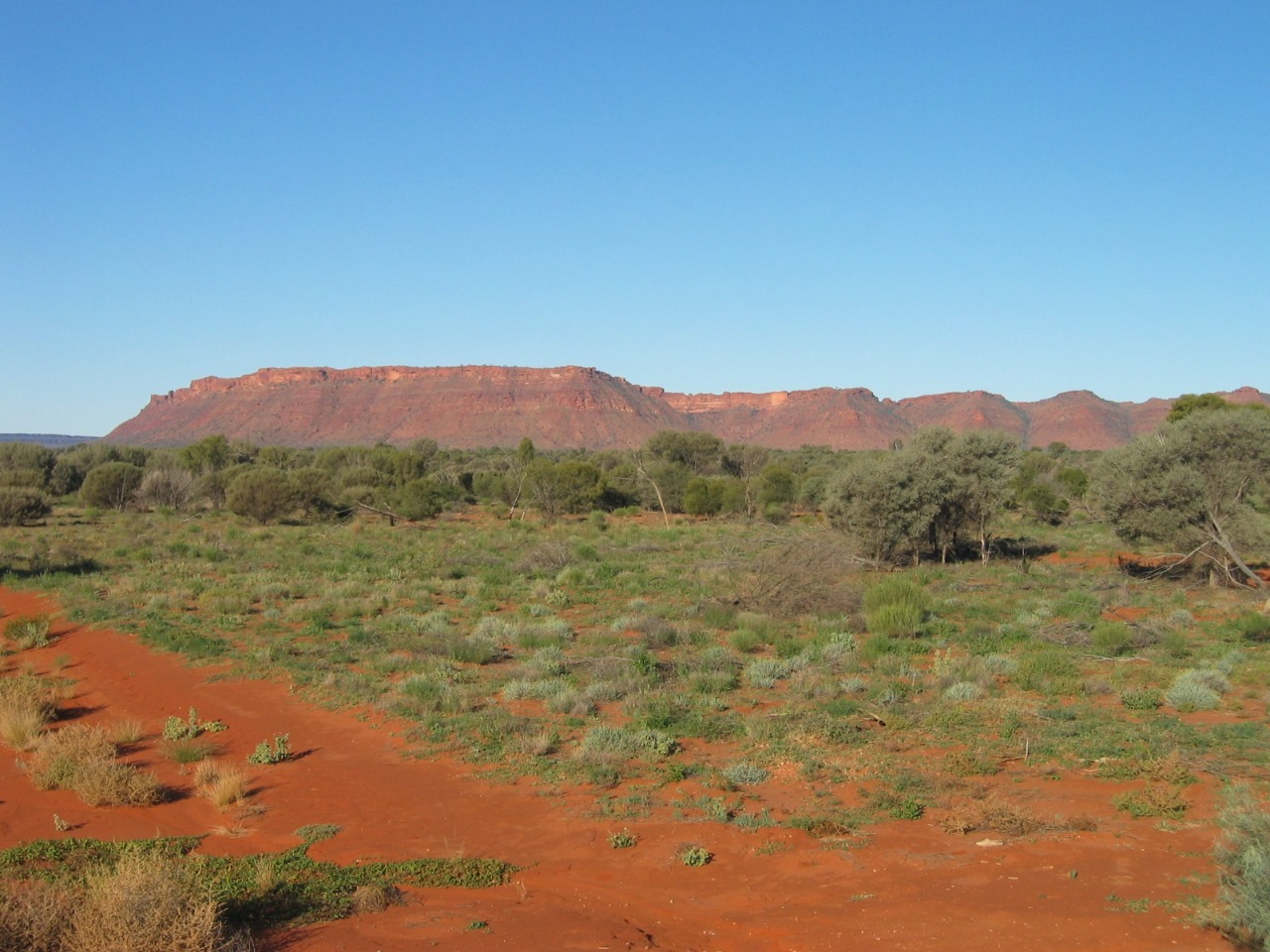
We left Yulara this morning for our 340 kilometre drive to King's Canyon, stopping after about 80 Kilometres to take photos of Mount Connor, which is located 75 kilometres southeast of Lake Amadeus at the border of the huge Curtin Springs Cattle Station. It reaches 859 metres above sea level, and 300 metres above ground level. It is a flat topped and horseshoe-shaped part of the rocky shelf thought to be beneath Ayres Rock. It can easily be confused with Ayres Rock, since it can be seen from the road to Ayres Rock.
We arrived at King's Canyon about 1:40pm and checked into the Resort, site 48. The cost was $35.50 per night.
We had a wonderful 2 days at the Canyon, doing several of the walks and a helicopter flight.
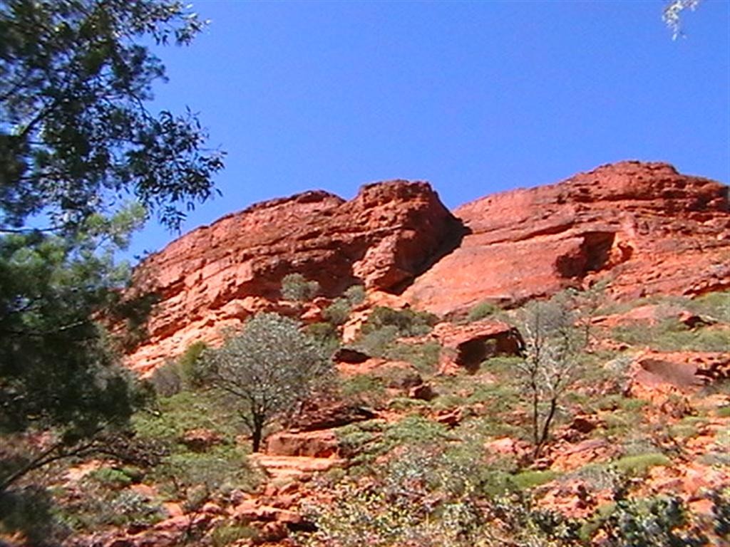
The walls of Kings Canyon are over 100 metres high, with Kings Creek at the bottom. Three walks exists at Kings Canyon. The 2 km (return) and approximately 1 hour Kings Creek Walk traces the bottom of the gorge. At the end of the walk is a platform, with views of the canyon walls above. The 6 km (loop) and 3-4 hour Kings Canyon Rim Walk traces the top of the canyon. A steep climb at the beginning of the walk, which locals call "Heartbreak Hill" (or "Heart Attack Hill", due to its steepness), takes visitors up to the top, with spectacular views of the gorge below and of the surrounding landscape. About half way during the walk, a detour descends to Garden of Eden, a permanent waterhole surrounded by lush plant life. The last half of the walk passes through a large maze of weathered sandstone domes. A slow descent brings the walkers back to the starting point.
I walked up Heart Attack Hill.
As with many tracks in the central Australian desert, visitors are advised to avoid walking during the middle of the day when the temperature is the highest and the sun most direct. Sunscreen, a hat, water and a fly net (in the hotter months) are essential.
The Kings Canyon Resort is 6 kilometres to the west and offers camping, budget rooms, standard hotel rooms and deluxe spa rooms, as well as restaurants and swimming pools. Kings Creek Station, 38 kilometres to the east is run and owned by Ian and Lyn Conway and offers alternative accommodation, and also provides camel rides and quad bike tours.
The highlight of our visit was the helicopter flight over the Canyon including a view of the rock platform where the Qantas ad. "We still call Australia Home" was filmed. The cast and crew had to be flown to the top by Chopper.
Another feature of our stay was laying in bed at night listening to the Dingos howling. They came right up to the perimeter of the Caravan Park. We always had to make sure we left nothing outside the Van before we went to bed.
It is Sunday morning 20th May and we are preparing for our drive to Alice Springs, which is a journey of approx. 490 Kilometres.
- comments