

Profile
Blog
Photos
Videos
Van Trip 2007

- Blog
- Oceania
-
Location Date New South Wales 1346454000 Queensland 1346367600 Victoria 1180825200 Northern Territory 
1180479600 South Australia 1179097200 -
Location Date Tennant Creek 1180479600 Barrow Creek 1180393200 Alice Springs
1179702000 Kings Canyon 1179529200 Yulara 1179183600
King's Canyon to Alice Springs
Days 31 to 38
Kilometres travelled today......489
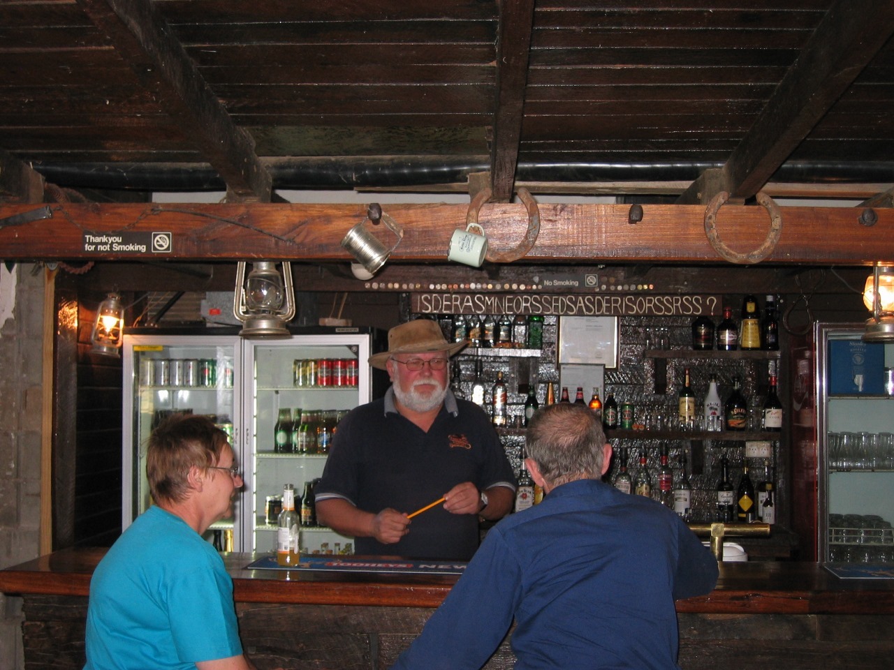
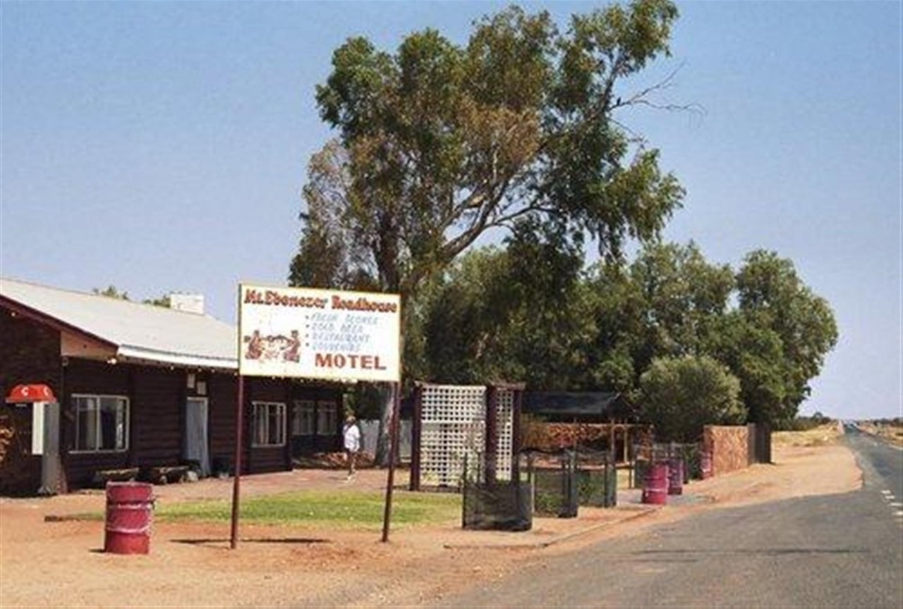
We reluctantly left King's Canyon this morning for our long drive to Alice Springs. The first part of the journey was on the Luritja Road, which runs from King's Canyon for a distance of 166 kilometres until it joins the Lasseter Highway approximately half way between Curtin Springs and the Mt. Ebenezer Roadhouse. Mt Ebenezer is one of the few Aboriginal-owned roadhouses in the Northern Territory The roadhouse and campground sits in country that's remarkably flat compared to its neighbours down the road, Uluru / Ayers Rock and Kata Tjuta / The Olgas. The roadhouse also boasts an impressive art gallery with a floor of red sand and walls of hessian and a wide range of local Imanpa Community paintings and carvings.
After a short stop at the Ebenezer Roadhouse we continued on for a further 55 kilometres to Erldunda, which lies at the junction of the Lasseter and Stuart Highways, where we enjoyed a very nice lunch.
Erldunda is approx 199 km from Alice Springs, 265 km from Ayers Rock, 1683 km from Darwin and 1337 km from Adelaide..
The roadhouse also offers accommodation for visitors travelling to Ayres Rock
The Erldunda Desert Oaks Motel & Caravan Park has 100 powered caravan sites, 47 motel units and budget units. They also have a great tavern and restaurant and swimming pool. It is located on 20 hectares being carved off the edge of Erldunda Station some time ago.
After leaving Erldunda, with another 200 kms to go to Alice Springs, we stopped several times along the way for photographs. The first of the stops was near Palm Valley, within the Finke Gorge National Park. Palm Valley and the surrounding area is the only place in Central Australia where Red Cabbage Palms survive.
The average rainfall for Palm Valley is only 200 mm per year. Although the Gorge usually appears dry, there are some small pockets of spring-fed pools that allow the flora in this region to survive.
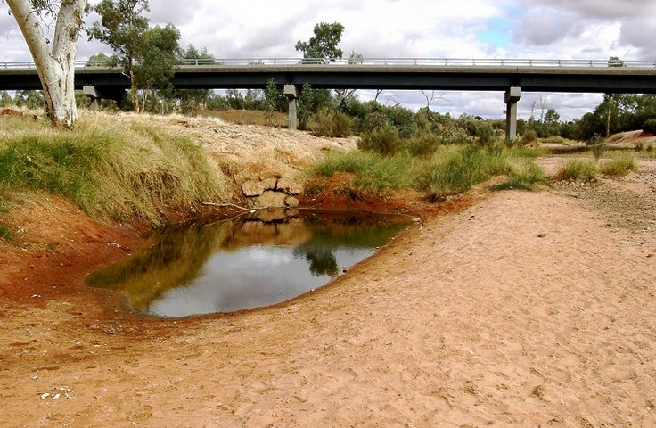
The second stop was the Finke River crossing. The river rarely runs full of water but is usually a string of waterholes; where we stopped a solitary pool in the riverbed contained water which was less than crystal clear. The Finke River rises in the MacDonnell Ranges near Glen Helen and flows 600 kilometres to its end in the Simpson Desert somewhere north of Oodnadatta. During extraordinary rainfall, water from the Finke continues into the Macumba River and onward into Lake Eyre.
After crossing the Finke River the road negotiated several chains of rocky hills lying across the run of the road. The highway usually went between outcrops and hills so it avoided any need to climb, or followed a route over the lowest hills.
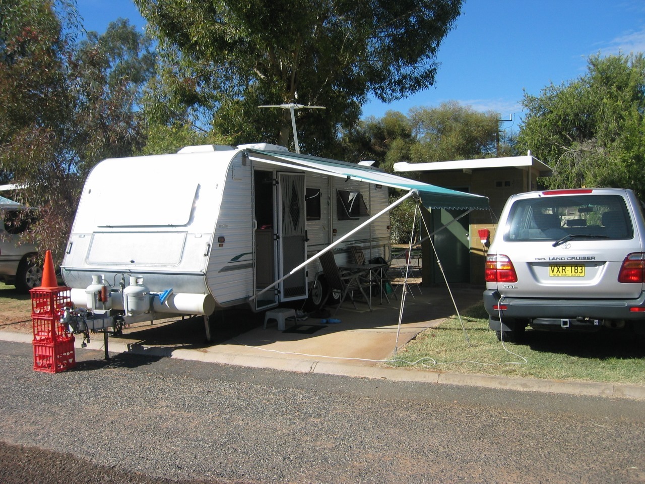
Arriving in Alice Springs we made our way to the Big 4 MacDonnell Range Holiday Park where we had booked before we left King's Canyon. We moved on to en-suite site number 240 at $35.00 per night.
The site was a bit too short for our van, which meant our drawbar was protruding onto the road. For safety reasons the park management had to place a witches hat at the front of our van.
We were to remain in Alice for 8 days.
Alice Springs is the third largest town in the Northern Territory. Popularly known as "The Alice" It is situated in the geographic centre of Australia near the southern border of the Northern Territory. "Alice" was named by surveyor W. W. Mills after Lady Alice Todd wife of Sir Charles Todd. Alice Springs has a population of 25,186 people, which makes up 12 percent of the territory's population.
The town of Alice Springs straddles the usually dry Todd River on the northern side of the MacDonnell Ranges, and is an arid environment consisting of several different deserts. In Alice Springs, temperatures can vary dramatically with an average maximum temperature in summer of 35.6 °C, and an average minimum temperature in winter of 5.1 °C.
During our stay in Alice we visited all the tourist sites and were amazed at the beauty of many of them,
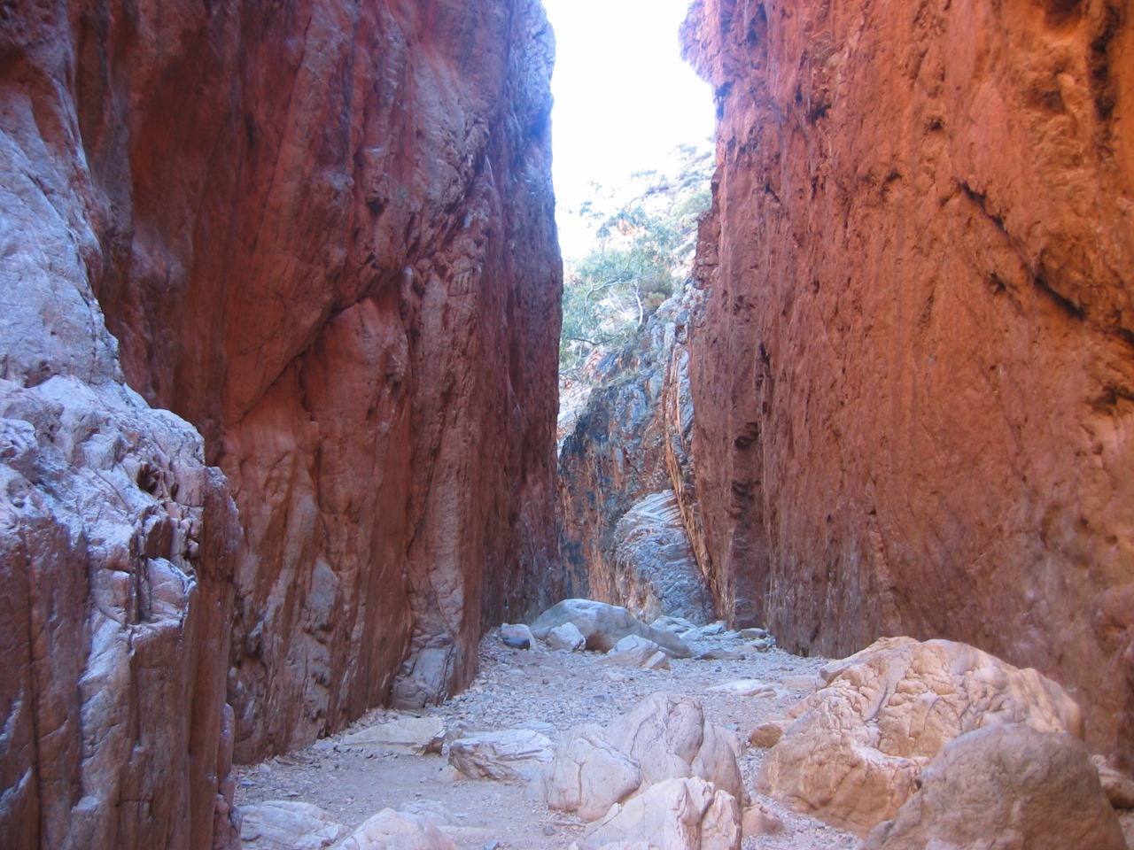
Our visit to Standley Chasm was one of the features, The Chasm is situated 50km west on Larapinta Drive.
20 minute one-way Standley Chasm walk is a scenic walk through a rocky, shaded gorge. The rare MacDonnell Ranges Cycads are common in this special, sheltered gorge. The small Black-footed Rock-wallabies are also common.
The walk closes in as you approach the chasm area. A chasm is a narrow gorge or slot in the range. Midday provides the best opportunity to see the effect of the overhead sunlight on the chasm walls. The walls blaze into unbelievable reds and oranges.
Following the Chasm trip we visited the old Telegraph Station. which was built in the 1870s near a water hole of the dry Todd River.
The Australian overland telegraph lines were to run north to south at this spot where a town originally named Stuart was established in 1888. Stuart became known as Alice Springs in 1933. The old telegraph station, two kilometres north of the town, is now a
museum.
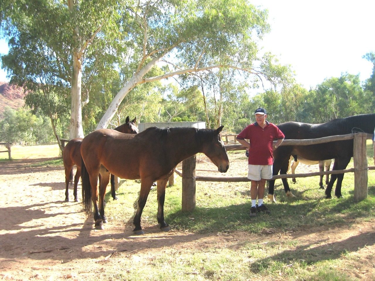
Our final site-seeing trip was to The Ross River Station, which we found eighty-five kilometres from Alice Springs at the end of a sealed road in the East MacDonnell Ranges. Although the bitumen narrowed to a single lane for the last thirty kilometres or so, there is room to pass any on-coming traffic.
The original stone hut homestead, formerly Loves Creek Homestead, is believed to have been built in 1898. In 1925, Loves Creek Station had up to four thousand horses and by the 1930s had established a decent cattle herd.
Shortly after 1955, the Green brothers, realising the area had a lot to offer tourists, leased forty acres of the property and developed the homestead as Ross River Homestead Tourist Resort, which officially opened in 1960 with four cabins and one room in the homestead for visitors.
Today, the resort has thirty cabins, a restaurant, bars and caravan and camping facilities that include thirty powered sites. An old school house is now a forty-eight bed bunkhouse. In fifty years there have been many changes; the log cabins are air-conditioned with en-suite bathrooms, there's a swimming pool and spa, conference facilities, fuel, WI-FI, airstrip and helipad.
We spent a very enjoyable day exploring the area, and enjoying a beer and lunch with the owners. The whole area was like a oasis in the dessert.
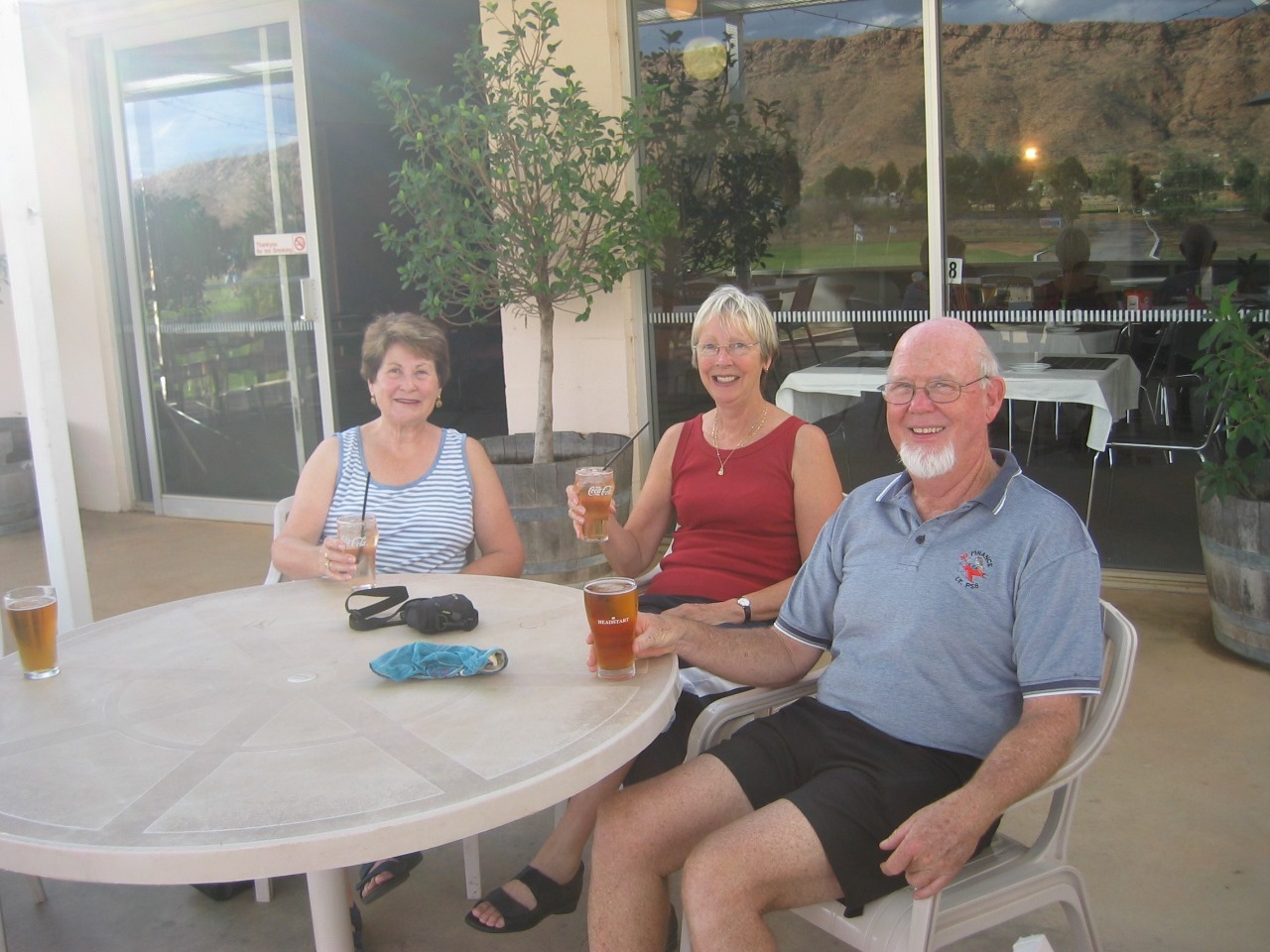
Later in the afternoon we made our way back to the Van Park and enjoyed happy hour with our friends David & Cindy Bell, who had been travelling with us, on & off since Coober Pedy.
This was to be our last night, and also our farewell to David & Cindy, who were leaving a day later to head for Darwin, whilst we intended turning right at the Three Ways and heading back through Mount Isa to Cairns.
When we left home it was our intention to go to Darwin, but during the course of our stay in Alice we made a decision to change our plans and head for the north Queensland Coast.
Days 31 to 38
Kilometres travelled today......489
We reluctantly left King's Canyon this morning for our long drive to Alice Springs. The first part of the journey was on the Luritja Road, which runs from King's Canyon for a distance of 166 kilometres until it joins the Lasseter Highway approximately half way between Curtin Springs and the Mt. Ebenezer Roadhouse. Mt Ebenezer is one of the few Aboriginal-owned roadhouses in the Northern Territory The roadhouse and campground sits in country that's remarkably flat compared to its neighbours down the road, Uluru / Ayers Rock and Kata Tjuta / The Olgas. The roadhouse also boasts an impressive art gallery with a floor of red sand and walls of hessian and a wide range of local Imanpa Community paintings and carvings.
After a short stop at the Ebenezer Roadhouse we continued on for a further 55 kilometres to Erldunda, which lies at the junction of the Lasseter and Stuart Highways, where we enjoyed a very nice lunch.
Erldunda is approx 199 km from Alice Springs, 265 km from Ayers Rock, 1683 km from Darwin and 1337 km from Adelaide..
The roadhouse also offers accommodation for visitors travelling to Ayres Rock
The Erldunda Desert Oaks Motel & Caravan Park has 100 powered caravan sites, 47 motel units and budget units. They also have a great tavern and restaurant and swimming pool. It is located on 20 hectares being carved off the edge of Erldunda Station some time ago.
After leaving Erldunda, with another 200 kms to go to Alice Springs, we stopped several times along the way for photographs. The first of the stops was near Palm Valley, within the Finke Gorge National Park. Palm Valley and the surrounding area is the only place in Central Australia where Red Cabbage Palms survive.
The average rainfall for Palm Valley is only 200 mm per year. Although the Gorge usually appears dry, there are some small pockets of spring-fed pools that allow the flora in this region to survive.
The second stop was the Finke River crossing. The river rarely runs full of water but is usually a string of waterholes; where we stopped a solitary pool in the riverbed contained water which was less than crystal clear. The Finke River rises in the MacDonnell Ranges near Glen Helen and flows 600 kilometres to its end in the Simpson Desert somewhere north of Oodnadatta. During extraordinary rainfall, water from the Finke continues into the Macumba River and onward into Lake Eyre.
After crossing the Finke River the road negotiated several chains of rocky hills lying across the run of the road. The highway usually went between outcrops and hills so it avoided any need to climb, or followed a route over the lowest hills.
Arriving in Alice Springs we made our way to the Big 4 MacDonnell Range Holiday Park where we had booked before we left King's Canyon. We moved on to en-suite site number 240 at $35.00 per night.
The site was a bit too short for our van, which meant our drawbar was protruding onto the road. For safety reasons the park management had to place a witches hat at the front of our van.
We were to remain in Alice for 8 days.
Alice Springs is the third largest town in the Northern Territory. Popularly known as "The Alice" It is situated in the geographic centre of Australia near the southern border of the Northern Territory. "Alice" was named by surveyor W. W. Mills after Lady Alice Todd wife of Sir Charles Todd. Alice Springs has a population of 25,186 people, which makes up 12 percent of the territory's population.
The town of Alice Springs straddles the usually dry Todd River on the northern side of the MacDonnell Ranges, and is an arid environment consisting of several different deserts. In Alice Springs, temperatures can vary dramatically with an average maximum temperature in summer of 35.6 °C, and an average minimum temperature in winter of 5.1 °C.
During our stay in Alice we visited all the tourist sites and were amazed at the beauty of many of them,
Our visit to Standley Chasm was one of the features, The Chasm is situated 50km west on Larapinta Drive.
20 minute one-way Standley Chasm walk is a scenic walk through a rocky, shaded gorge. The rare MacDonnell Ranges Cycads are common in this special, sheltered gorge. The small Black-footed Rock-wallabies are also common.
The walk closes in as you approach the chasm area. A chasm is a narrow gorge or slot in the range. Midday provides the best opportunity to see the effect of the overhead sunlight on the chasm walls. The walls blaze into unbelievable reds and oranges.
Following the Chasm trip we visited the old Telegraph Station. which was built in the 1870s near a water hole of the dry Todd River.
The Australian overland telegraph lines were to run north to south at this spot where a town originally named Stuart was established in 1888. Stuart became known as Alice Springs in 1933. The old telegraph station, two kilometres north of the town, is now a
museum.
Our final site-seeing trip was to The Ross River Station, which we found eighty-five kilometres from Alice Springs at the end of a sealed road in the East MacDonnell Ranges. Although the bitumen narrowed to a single lane for the last thirty kilometres or so, there is room to pass any on-coming traffic.
The original stone hut homestead, formerly Loves Creek Homestead, is believed to have been built in 1898. In 1925, Loves Creek Station had up to four thousand horses and by the 1930s had established a decent cattle herd.
Shortly after 1955, the Green brothers, realising the area had a lot to offer tourists, leased forty acres of the property and developed the homestead as Ross River Homestead Tourist Resort, which officially opened in 1960 with four cabins and one room in the homestead for visitors.
Today, the resort has thirty cabins, a restaurant, bars and caravan and camping facilities that include thirty powered sites. An old school house is now a forty-eight bed bunkhouse. In fifty years there have been many changes; the log cabins are air-conditioned with en-suite bathrooms, there's a swimming pool and spa, conference facilities, fuel, WI-FI, airstrip and helipad.
We spent a very enjoyable day exploring the area, and enjoying a beer and lunch with the owners. The whole area was like a oasis in the dessert.
Later in the afternoon we made our way back to the Van Park and enjoyed happy hour with our friends David & Cindy Bell, who had been travelling with us, on & off since Coober Pedy.
This was to be our last night, and also our farewell to David & Cindy, who were leaving a day later to head for Darwin, whilst we intended turning right at the Three Ways and heading back through Mount Isa to Cairns.
When we left home it was our intention to go to Darwin, but during the course of our stay in Alice we made a decision to change our plans and head for the north Queensland Coast.
- comments