

Profile
Blog
Photos
Videos

- Blog
- Africa
- Tanzania
-
Location Date Mount Kilimanjaro 
1295913600 Tarangire 1295827200 Ngorongoro Crater 1295740800 Lake Manyara 1295654400 Arusha 1295568000
DAY 1
After breakfast, I was collected from the hotel by our guide John and the rest of the team which numbered 11 in total. Harold, the assistant guide, cook Joseph and 8 porters. We drove into Arusha to collect my trekking companion, Jim from Mechanicsburg near Pittsburgh, PA.
There are several routes up Kilimanjaro and we've selected the (unique) Rongai Route. This is also known as the Nalemuru Route after the nearby river, is the only route that starts from the north. Since Arusha is south and west of Kilimanjaro, we had to travel around the mountain to get to Rongai Gate, which took about 4 1/2 hours.
We arrived at the start around 12:30. There were lots of folks there getting ready to begin - from from Canada, Australia, Denmark, Sweden and California. We registered, ate lunch, made final preparations, and were underway about 2:30.
Assistant guide Harold walked with us. We started out hiking through pine forests with some ferns and other plants interspersed with farm fields planted in corn and potatoes. There were some beautiful flowers including the striking flame lilly. The footpath was dirt for the first couple of miles. Later on, it became lava rock with lots of juniper surrounding us. We passed a family of baboons right on the trail.
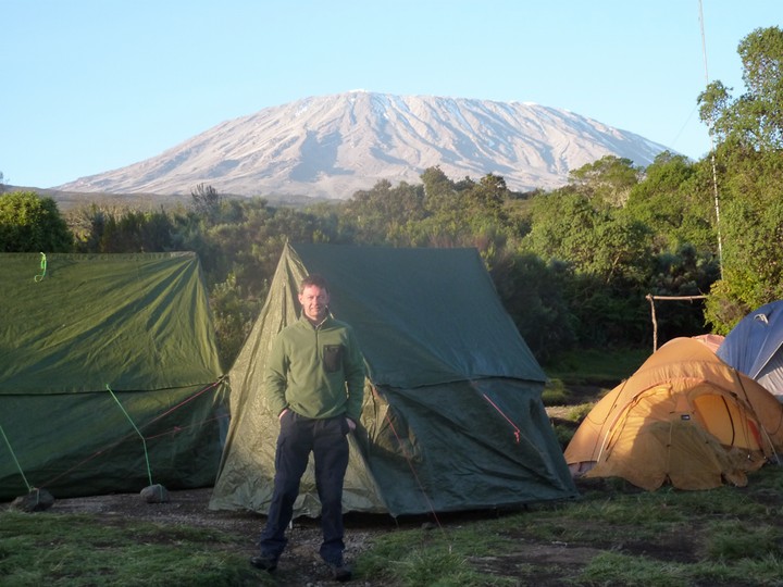
We got to Simba Camp, our camping spot for the night, around 4:45. Our first day's hike was just 7 km. The porters set up camp and we had tea. At around 6:30 we had dinner, including lentil soup and beef stew over potatoes. We started hiking at about 6,600 feet and are camping at around 8,600.
It was quite warm during the day but is getting steadily colder with nightfall. Everyone doing the Rongai Route stops here the first night, so we are among lots of campers. I'd guess a total of around 20 trekkers and maybe 70 or 80 guides, porters, etc. Jim and I looked at the brilliant sky before turning in. We are just below the equator, so the stars are rather unfamiliar to us. We looked for the Southern Cross, which is very prominent in New Zealand, but I wasn't sure I found it.
DAY 2
We woke up at 6 pm and coffee and tea were delivered to us in our tent.
After a good breakfast we set off around 7:45. The hike to lunch was a steady climb of 5.8 km over a mostly smooth footpath through the heather region. On the way we stopped at First Cave. The cave has a hole in the top and you can stick your head out of it. Shortly after that, around 11, we got to Second Hut. The porters had raced ahead and lunch was ready about a half hour later. There were great views of Kibo and Mawenzi, two of the three peaks on the mountain.
The morning trek seemed pretty easy, but we had gained about 2,800 feet of altitude, to 11,440. We started to notice this in the afternoon. We hiked 6 km over uneven and sometimes rocky terrain. Though we only gained about 600 ft. on the afternoon trek to **** elwa, it seemed a lot harder than the morning. We arrived about 3 pm.
Jim and I both survived it pretty well, but we both feel like we have done a full days work. It was another picture perfect day with just a few puffy clouds. Tomorrow should be somewhat easier. Another excellent dinner by cook Joseph.
DAY 3
It was a little colder last night than the one before. After breakfast, we were underway at 8:15. The juniper keeps getting smaller as we climb. The first part of the hike was a steady uphill on a good footpath. At a rest spot, we met Jonathan and Richard, two young Americans that Jim had ridden in to Arusha from the airport with. They are trekking with Team Kilimanjaro, with which Climb Mt. Kilimanjaro is affiliated. They were trekking with a lady from Australia who had to bail out due to back problems. We met her going back down the hill two days ago. That caused them to lose a day, meaning we will probably summit the same day as them. We passed by some interesting African cactus on the way. We pulled in to Mawenzi Tarn about 11. After lunch, we rested a bit. I had a bit of a headache, which is quite usual at this stage and a couple of Ibuprofen did the trick. In late afternoon we did a short hike about 500 feet further up the mountain to further acclimatize ourselves. The climb up was over volcanic rocks and loose gravel. We were led by Dullah, our waiter. He is training to become a guide. He will learn about the various routes, become proficient in English and pass an exam. We stopped at an overlook, at which we could see both our campsite and much of tomorrow's route. The overlook where we turned around is at about 15,000 feet. We've been offered the option to make a change to our itinerary. Tomorrow we will go to School Huts, the last stop before the the summit instead of the original destination which is at a lower altitude. We are just above tree line and the terrain is mostly volcanic rock and sand. Beautiful Mawenzi peak towers just above us. Mawenzi has some snow and ice on it. John explained that ice and snow are temporary. It forms during the rainy season and then mostly melts during warmer weather. The permanent ice and snow are near the Uhuru summit near the Kibo crater. Just before it got dark, we looked over the edge to the land at the base of the mountain. To our surprise it was totally covered in a layer of clouds. They extended up to about a thousand feet below our elevation. Up here all the way to the summit it is clear with just an occasional wisp of a cloud.
DAY 4
By dawn the cloud bank below us had completely dissipated. We went to bed early last night and spent over 10 hours in our sleeping bags. We were underway by 8:15. We crossed over the same ridge that we climbed yesterday during the acclimatization hike, but this time using an easier route. We then entered a sort of high desert plateau known as The Saddle. On the way, saw plants like thistle and everlasting purple. About an hour from the end today we came upon a light aircraft crash site. It was a tourist plane from Kenya that ran into mechanical problems four or five years ago. There was also evidence of the animals that sometimes cross here in search of salt leaching from the rocks - buffalo dung! We arrived at camp around 1 pm. After lunch we went on another short acclimatization hike like yesterday. We have the option of doing a rest day tomorrow and then beginning the summit assault around midnight the next morning. Under that plan we would summit around sunrise. We have decided instead to start the summit around 6 am tomorrow morning, summit around midday and return here for the evening. That will still make the summit day a long one, but not as long as if we did the rest day and tried for the sunrise summit. Not much wildlife up here at 15,500 ft., except for the white neck ravens. They look very much like our crows or ravens, except for the white stripe on their necks. They get awfully big, presumably they scavenge on our leftovers at this height.
DAY 5
Not much sleep last tonight. We awoke to almost perfect conditions for 15,400 feet, clear and cold, maybe 28 degrees F. The water froze in the tube of my hydrationpack, but not in the bag itself. We were away by 6:00, just after sunrise. The sun was beautiful as it came up from behind Mawenzi peak.
It's about 1.2 mi. from School Huts to above Kibo Huts, where we joined the main Marangu route up at William's Point. The trail was moderately uphill over rocks and gravel scree. A short uphill followed to Hans Meyer Cave. This is named for the first European to summit in 1889.
Next came the hardest section by far of the entire trek. The path goes steadily uphill on switchbacks through loose scree that easily gives way. It's something like slogging through thick mud. We both had to stop a few times due to catch our breath at 17,500 elevation.
We made it to Gillman's Point around 10:30 where we rested and had a snack. Before us we saw the first view of the eastern glacier and the crater floor. Spoke to a couple living in Hong Kong. She's English, he's Norwegian.
After a break, we began the walk along the crater rim to Uhuru Peak. We got indescribable views of the moonscape around the crater floor below, and gorgeous glaciers to the left and right.
I decided to listen to my ipod but my mind started playing tricks with me and I testing myself trying to do simple mental arithmetic which proved quite a challenge. Although the air up here contains the same percentage of oxygen, the air pressure is roughly half that at sea level so it's difficult forcing it into your system. My heart was beating faster too even when resting and I experienced a tingling sensation in my fingers - all normal symptoms of mild AMS.
We made it! Arrived at the Uhuru summit almost exactly at noon (11:58 actually), 19,341 feet (5895m). We got the usual commemorative pictures of the four of us at the summit sign, which describes Kilimanjaro as the tallest mountain in Africa and the highest freestanding peak on earth. We ate a small lunch plus some snacks and a Red Bull during our 45 minutes there. Another couple arrived just as we were leaving, and we took each others' pictures. I think summiting this time of day is much better, if not only because we had the top to ourselves. Later we heard from the sunrise folks that it gets pretty busy up there.
The trip back to School Huts was much easier. "Scree-skiing" almost straight down the loose gravel. We did a controlled slide down the gravelly slope with expert Harold leading the way. It took maybe 30 minutes to go down from Gillman's Point to the School Huts cut-off trail, a section that took 2-1/2 gruelling hours to climb.
We arrived back in camp at 3 pm, tired but very happy to be done. We laid around for most of the remaining day, eating a small late lunch and then dinner.
DAY 6
Another bright, clear morning, not quite as cool as yesterday. We left at 9 am starting with a nice, pleasant walk over the high plains desert known as The Saddle. We are returning via the Marangu Route. It's also known as the "Coca Cola Route", because it is so easy. It is noticeably easier than the Rongai Route we took up. The path is wide enough to drive a vehicle on through mostly small rocks, dirt and sand. However, more people fail to summit on the Marangu than any other. This is most likely since people are attracted to it as an "easy" route, and there's no place to train for the hard section north of Kibo. Jim and I feel that the Rongai trained us pretty well for that section. The part from Kibo to Gillmans was still pretty hard, however. We got to Horombo Huts around noon. Just before Horombo the terrain changed suddenly from desert to scrub brush, mostly juniper. We resumed around 1 pm after lunch, and the skies looked threatening the lower we got. Twenty minutes later we heard thunder. Light rain started about a half hour after that. We hiked through intermittent showers for a couple of hours as the scrub brush got larger and larger. Harold showed us clear evidence of a major fire a few years ago. Then, just as suddenly as the desert changed to scrub brush, it changed again to hardwood forest with Spanish moss, with the ground covered in grasses. We arrived at the Mandara Huts around 4 pm amid scattered showers. Huge elevatation drop today, from around 15,500 ft. to 8,900.
We talked to a guy who had struggled in just before us. It turned out he had started out from Kibo at midnight, summited, and then come down all the way to Mandara, for a 16 hour day. It was only about four miles less than what we had done the past two days. We were pretty impressed.
DAY 7
It rained off and on through the evening, but the skies were clear by early morning. Lots of creature sounds in the surrounding forest especially the Colubus Monkeys which are incredibly noisy. We Everyone was eager to finish, and we were off about 7:30.
As we got lower, the forest got thicker and turned into a true rain forest. This is the lush area in the shadow of the mountain that gets huge rainfall and runoff from the mountain. It is famous for raising coffee and tea. Most of the trees here are covered in moss and begonia vines. We could hear the sounds of monkeys and birds close by.
Near the end, we noticed several black stringy things across the trail. These were ants swarming from one location to another. Harold told us they were red ants with a severe bite. I picked some up with a stick and dropped some ginger biscuit in their path but they weren't interested.
The forest gradually opened and were returned to Marangu Gate, where we had registered seven days ago before going to Rongai Gate to start. Elevation 6,250 ft. We saw several trekkers getting ready to start and I had a chat with the organiser of a large group of Brits from British Heart Foundation.
Finally we boarded our bus to take us back to Arusha. On the way, John, Harold, Jim and I had a final lunch together in Moshi. Steak and Chips was amazing after a week of porridge & soup! They gave us our official certificates showing that we had climbed Killy. We thanked them and the rest of the crew for the great job they did help us to get there.
- comments