

Profile
Blog
Photos
Videos

- Blog
-
Location Date Europe 1431471600 South America 
1430521200 North America 1425513600 -

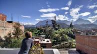
After a not-to-comfortable 10 hour overnight bus ride we arrived in Huaraz, the capitol of the Ancash province in Peru's central Andes. It's located Northeast of Lima, a little less than 200km in from the Pacific coast. It's dominated by mountains, most notably the heavily glaciated Cordillera Blanca range that stretches over 150km from North to South and has over 60 different peaks over 6000 meters. In recent decades it has become an often cited example of global climate change as the glaciers slowly shrink. Many people who live in the region fear that in 50 years the glaciers will be gone, along with the fresh water streams they supply to many small towns and farms.
Despite the threatened glaciers, the mountains that surround Huaraz are still breathtaking and when they would peek out of the clouds they dwarfed the town nestled between them.
When we arrived we were exhausted from the sleepless bus ride and the altitude of over 3000 meters (~10,000 feet). We slept most of the day, waking up to drink coca tea (a traditional remedy to help reduce altitude sickness) and eat.
On day two we met up with a friend we met on Couchsurfing named Jose who is about our age and from Huaraz. He had a traveler from Switzerland staying with him so couldn't host us but we all met up and went for a day hike to small lake 20 minutes south of Huaraz named Lagoona Wilcacocha. It was a beautiful hike that wound up through a small village that was surrounded by fields of potatoes, peas, corn, and quinoa. The trail wasn't really marked but we asked most of the locals we saw and generally got pointed in the same direction. When we reached the top of the ridge, hearts pounding and out of breath from the altitude, we were rewarded with sweeping views of the surrounding mountains and a refreshing lunch of fresh fruit and cheese empanadas that we picked up that morning. On our way down we got caught in a pretty heavy rain (complete with lightning that caused the power lines overhead to pop and buzz) but we made it back to our hostel soaking wet and safe.
The next few days were mainly spent getting Molly better after some sort of fd related illness. most likely from cactus fruit we got at the market before our first little hike. In retrospect, having to lay low for a few days was a good thing because we stayed in Huaraz a little longer than we would have and had time to acclimatize before starting a 3 day backpacking trip in the mountains.
The Santa Cruz Trek is a popular 3-4 day trek that crosses the Cordillera Blanca. It's about 50km and can be done with a guide and donkeys or without a guide if you have the right equipment and are comfortable backpacking your own. After getting some information and maps from a guide who works with the hostal we were staying at, we decided to do it on our own. We left town at 5am and took two colectivos (one of the most common forms of public transport here, small vans that fit about 10 people, luggage, and maybe a cage of chickens) to arrive at the small village of Vaqueria by 1030am. The last 3 hours of the drive offered breathtaking views of green pastures,rocky mountains, and glaciers as we drove deeper into the Parque Nacional Huascaran. It was also the bumpiest ride either of us had ever experienced and we had plenty of bruises on our heads to prove it.
Day one took us through increasingly remote pastures and occasional adobe, tin roofed houses that were reachable only by foot. We traveled along a small stream up a long valley towards the first campsite. We were occasionally besieged by little children asking for cookies but we resisted the urge to give them any, not knowing exactly how long the trip would take us and whether or not our food would last us. We made a few other friends along the way, including a Spaniard who we spent most of the trek with, and a small red dog who reminded us a lot of one of our Seattle dog friends, Juju. We tried to get the dog to stop following us but he wouldn't turn back and ended up tagging along for the whole trek. By the end of day two we gave in and fed him a little and named him Poncho. He thanked us by guarding our tent at night from marauding donkeys who wandered too close.
It rained hard off and on each night starting around 4 pm, so we made a point to set up our tent early, baton down the hatches, and try to stay dry. We got a little wet but managed to stay warm.
The scenery was incredible. We were surrounded by jagged mountains, glacial lakes and streams, and occasional grazing cows, horses, donkeys and sheep. Despite the popularity of the route we only saw 1 or 2 other groups each day and really felt like we were miles and miles from civilization.
At the end of day 2, we crossed a large valley that had been the site of a large alluvion (mud and rock slide) in 2012 when a rain swollen, glacial lake burst through the rocks and earth that held it in it's high perch, bringing down an immense amount of rock, mud, and trees with it. Boulders and twisted tree trunks were strewn across the valley and served as a strong reminder of just how devastating nature can be.
We reached our final destination, Cashapampa, by midday on day 3. We had to say goodbye to Poncho, but we had the feeling that it wasn't the first time he had done the trek and it wouldn't be the last. We caught a bus back to Huaraz which was much less crowded and more comfortable than the one we had arrived to Vaqueria on. A hot shower never felt so good.
- comments