

Profile
Blog
Photos
Videos
Van Trip 2007

- Blog
- Oceania
-
Location Date New South Wales 1346454000 Queensland 
1346367600 Victoria 1180825200 Northern Territory 1180479600 South Australia 1179097200 -
Location Date Mundubbera 1346367600 Airlie Beach 1345676400 Ayr
1345590000 Cooktown 1344726000 Cairns 1343775600 Cardwell 1343689200 Townsville 1342479600 Capella 1342134000 Emerald 1342134000 Roma 1341961200 St George 1341874800 Taroom 1183071600 Goondiwindi 1183071600 Rockhampton 1182898800 Sarina 1182812400 Rollingstone 1181084400 Charters Towers 1180998000 Mount Isa 1180566000 -
Location Date Wed, 22 August 2012 1345665840 Wed, 22 August 2012
1345644120


Day 52
Kilometres travelled........266
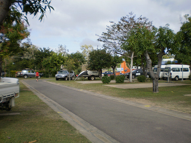
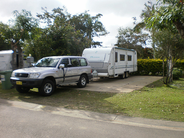
After farewelling Ralph & Lee we headed off for today's journey to Ayr. Along the way we stopped in Townsville for coffee and a relaxing break. Checked into the Ayr Silver Link Van Village, site 55. We rated it an excellent park and were disappointed we had only booked for 2 nights. Weather was very warm.
Ayr is near the Burdekin River, it was named after the Scottish town of Ayr by the settlers from the United Kingdom. It produces the most sugar cane per square kilometre in Australia, utilising underground water supplies and water from the Burdekin Dam to irrigate crops. It is located 88 km south of Townsville on the Bruce Highway and 12 km away from Home Hill. It is 112 km north of Bowen and 290 km north of Mackay . The town has a population of approximately 8,000.
Home Hill lies approximately 98 km south of Townsville and 1269 km north of Brisbane on the Bruce Highway. It is a part of the Burdekin region which includes the neighbouring town of Ayr.
The main attractions in Home Hill are the Burdekin Bridge, Inkerman Sugar Mill and Ashworth's Rock Shop. In the past few years it has become increasingly popular for backpackers, who flock to the area to earn money planting and harvesting crops. Home Hill was originally part of the Inkerman Downs Cattle Station
The cattle station was converted to sugar cane in 1911 and the town developed quite quickly after the establishment of the Inkerman Sugar Mill in 1914.
The town was originally going to be named Holme Hill after a battle in the Crimea War. However, the signwriter wasn't given a written spelling of the name and made an error when creating the sign that inevitably read "Welcome to Home Hill". There is an alternative version of this story which says that the town was named after a certain Colonel Holme who had distinguished himself in the Crimean War. Either way, the signwriter made the mistake. Another mystery about the town name ….. the town is not built on a hill. It is on a fairly level river flat. The nearest hill is about 10 km away.
Kilometres travelled........266
After farewelling Ralph & Lee we headed off for today's journey to Ayr. Along the way we stopped in Townsville for coffee and a relaxing break. Checked into the Ayr Silver Link Van Village, site 55. We rated it an excellent park and were disappointed we had only booked for 2 nights. Weather was very warm.
Ayr is near the Burdekin River, it was named after the Scottish town of Ayr by the settlers from the United Kingdom. It produces the most sugar cane per square kilometre in Australia, utilising underground water supplies and water from the Burdekin Dam to irrigate crops. It is located 88 km south of Townsville on the Bruce Highway and 12 km away from Home Hill. It is 112 km north of Bowen and 290 km north of Mackay . The town has a population of approximately 8,000.
Home Hill lies approximately 98 km south of Townsville and 1269 km north of Brisbane on the Bruce Highway. It is a part of the Burdekin region which includes the neighbouring town of Ayr.
The main attractions in Home Hill are the Burdekin Bridge, Inkerman Sugar Mill and Ashworth's Rock Shop. In the past few years it has become increasingly popular for backpackers, who flock to the area to earn money planting and harvesting crops. Home Hill was originally part of the Inkerman Downs Cattle Station
The cattle station was converted to sugar cane in 1911 and the town developed quite quickly after the establishment of the Inkerman Sugar Mill in 1914.
The town was originally going to be named Holme Hill after a battle in the Crimea War. However, the signwriter wasn't given a written spelling of the name and made an error when creating the sign that inevitably read "Welcome to Home Hill". There is an alternative version of this story which says that the town was named after a certain Colonel Holme who had distinguished himself in the Crimean War. Either way, the signwriter made the mistake. Another mystery about the town name ….. the town is not built on a hill. It is on a fairly level river flat. The nearest hill is about 10 km away.
- comments