

Profile
Blog
Photos
Videos

- Blog
- North America
-
Location Date West Yellowstone 1372374000 Cameron 1369695600 Sheridan 1369436400 Dillon 1369263600 Wisdom 
1369090800
What a day. 78 miles from Hamilton to Wisdom climbing from 3570 feet to 7241 feet at the summit of Chief Joseph Pass. Truly exhausting and at the same time I'm so happy to have achieved this.
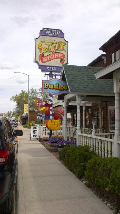
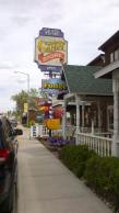
Started slowly as usual from Hamilton at around 9.45 once I'd picked up fuel for the journey. First stop the Montana cafe in the lovely town of Darby, Montana. I had a giant slice of carrot cake which I joked would get me over the pass. Fittingly they had a large hat shop (volume I guessed at more than 10 gallons). Also, a great looking old fashioned candy store. As I passed, weighed down by carrot cake and Pepsi, I noticed the giant chicken. Wonderful!
Next, I headed for a small town called Sula. It wasn't a town, it was a store, cafe, petrol station and a RV campground. All seemed to be ran by three people, which is, I guess, the population. I'd planned on having lunch there but the woman running the store told me it was closed Monday, Tuesday and Wednesday. So I had a big bag of crisps and a banana, filled up my water bottles and set off up the climb.
Now the wind was blowing in my face, and I had several long straight roads before reaching the steep bit. So I crawled 3.5 miles to where it began getting steep. This point turned out to be Lost Trail Hot Springs.
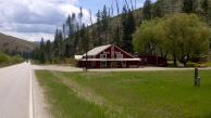
On the map this was a campground, restaurant and store with hot springs (of course) and a pool. So, with sore knees (early today) I thought I'd chance camping there for the evening. I cycled down the gravel road only to find it shut!
No water or more food now until Wisdom, about 37 miles from there.
The climb was tough but manageable. This being the highest I'd ever been - except in a plane. It climbed about 2000 feet in the 9 miles or so to the top. There was still a little snow in patches and you could see across where the ski runs are from where they've worn away the vegetation.
I reached the top of Chief Joseph Pass, and was asked by a lady in a 4x4, as she went by, was I okay? The one and only person to ask all day. As I had less than a bottle of water left; my energy was starting to dwindle; and it was growing darker with rainclouds and the onset of dusk; I panted "yes I'm fine thanks".
I regretted that many times over the next 2 hours or so.
Just as I was starting my descent, two Elk came into view at the side of the road. Beautiful creatures, which I knew, by now. to hang back from until they'd decided where they were going. Invariably this will involve them crossing the road in a mild sense of panic right in front of you. They duly obliged. No wonder there are so many signs warning road users of their presence. Also, sadly why I've seen at least a dozen deer dead by the road already.
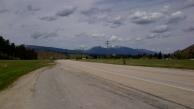
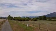
Anyway I pedalled hard into the wind down toward Wisdom. the next town. and my destination today. The last ten miles seemed to be on long straight roads across the Big Hole valley floor. I could now see why they called it Big Sky country.
The last miles were almost intolerable as I battled against the wind, out of energy. I even stopped at the Big Hole visitor centre (look it up, it's the site of a famous cowbags and onions battle - no the Big Hole river valley. not the visitor centre) when I saw a tent sign. As I got closer it was a no camping sign. Naturally, either not allowed or shut!
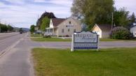
I hobbled into (can you hobble on a bike? I can) Wisdom, and not having the strength to set up a tent, and longing for a bath and a bed, I checked in at the Nez Perce Motel (a good motel - clean and not too expensive) from where I write this blog reader.
Today should have been 64 miles over 2 more passes to Dillon. I could barely move my legs this morning to get out of bed, let alone ride my bike. Besides the weather forecast was bad so here I am.
Tomorrow Dillon though disappointingly not down Highway 61.
- comments
tuby wow sounds v tuff terrain going over, especially with head winds and not being able to enjoy the down hills because of them at least no driving rain also, hope weather good but not to hot as you would frazzle.