

Profile
Blog
Photos
Videos

- Blog
-
-
Location Date Thingvellir 1345590000 Skogar 1345417200 Reykholt Seyðisfjörður Höfn 
Dyrhólahverfi Strandarkirkja Geysir Grindavík Reykjavik Ólafsvík Ísafjörður
Horn to Kirkjubæjarklaustur:
We left what must be one of the windiest place in Iceland and headed along the coast where the Vatnajökull glacier, the largest in Europe, almost reaches the sea.
We took a side road which soon turned into a very slow-going gravel track towards a tongue of the glacier called Hoffellsjökell. We drove through a shallow stream and finally up a steep slope onto the ridge of moraine left by the glacier at a former colder time and looked over a glacier lake with icebergs floating at the base of the cliff-edge of the glacier itself. The glacier moves, so the information boards (hooray, in English) say, at 2 metres a day, and so the edge of the mass of ice is deeply cracked and crevassed. It would be nigh impossible to make one's way across it at this edge.
Again the landscape changed dramatically. We entered a wide outwash plain of black sand and gravel, another remnant of the work of glaciers in times past. The black granite pebbles are highly polished and rounded and rivulets etch patterns in the plain like complex fishing nets over the vast flat spaces.
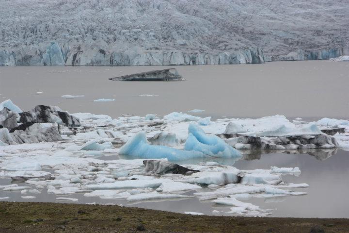
We knew there was something big coming up judging by the mass of cars and vans and buses parked by the side of a bridge on the main road. On the map it was marked Jökellsárlón - the Glacier Lagoon. Here was a huge lagoon with water flowing fast out to sea under the bridge. The lagoon was piled high with incredible icebergs: some white, some the most beautiful clear blue, some dirty and streaked with moraine and small ones the clearest and most transparent crystal. In the distance was the wide glacier front. When caught in the current, quite sizeable icebergs would break free and careen down to the mouth where they would be washed up on the black sand by the waves. And in this current, ducks swam with all their might against the flow and seals bobbed up and down.
A few kilometres further on we followed another gravel travel, mercifully not as rough or as long as the last one, and parked on a ridge above yet another glacier (Fjallsjökell) with its own enclosed lake (Fjallsárlón). Without the crowds and with the higher vantage point this was simply stunning.
And along the road, another glacier and another and another, some with high waterfalls cascading down from halfway up the mountain.
We stopped at Skaftafell to take the 45 minute walk to Svartifoss waterfall. From virtually sea level we climbed high up a pretty track. This region had plenty of vegetation, though only bushes and no trees. Pink, purple and yellow flowers brightened the way. Passing other waterfalls on the same river, we eventually reached the main attraction. The waterfall itself was not huge (though very high) but it was surrounded by walls of columnar jointed basalt, the peculiar pattern formed on cooling of the rock. It is similar to the Giant's Causeway in Northern Ireland and, believe it or not, to a basalt outcrop on the North Bondi Golf Course.
Another several kilometres and another world altogether: we entered a lava plain. Here the ground is all lumpy and bumpy, looking like some giant toothpaste tube has extruded the molten rock all over the plain. To make it look even stranger, the rocks are all covered in a pale, thick moss giving the surface the appearance of velvet.
We had a bit of trouble finding the campground for the night. The GPS coordinates sent us to a hotel. But back along the road, we recognised a waterfall in the photo of Kleifar Camp and there it was. To say that Icelandic campsites are basic would be understatement. Here we had 2 toilets and a small kitchen sink and nothing else. There wasn't even anyone to collect the 100 Kroners tax (about a dollar) we still have to pay on top of our free Camping Card. But the view was good and the site quiet and we slept much better than the night before.
- comments